Start with the route choice, not the waterfall photo
Akchour is a mountain outing from Chefchaouen, not a single short stroll to one viewpoint. The approach from the village reaches a dam where the trails diverge: the path toward the cascades follows the Kelaa River, while the route to God's Bridge follows the Farda River. The official Moroccan tourism site describes both Akchour and the natural arch as part of the surrounding Rif mountain landscape; it places the bridge about 25 metres above the river. 1
The most useful decision is how much walking you want to do and whether you are comfortable with uneven ground. The bridge is commonly described as the shorter option. The waterfall route offers a gradual riverside approach to the Petite Cascade, then becomes more demanding if you continue toward the Grande Cascade. A destination specialist describes the upper section as steeper, narrower and crossed by streams, with slippery stones and muddy stretches; that terrain matters more than the label “easy” sometimes used in casual listings. 2
If you have only a half day, prefer the bridge or a walk to the lower falls and back. With a full day and good footing, choose the waterfall route and decide at the lower cascade whether to continue. Attempt both only if you start early, have enough energy for a long day and have confirmed a ride home. There is no need to collect both landmarks at the cost of rushing the trail or missing your return transport.
Choose the waterfall trail or God's Bridge
Waterfalls: the more varied, longer outing
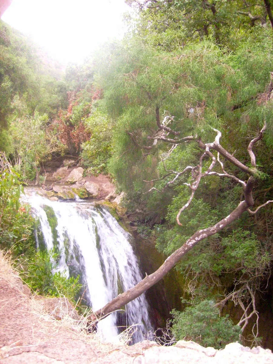
From the dam, the waterfall path runs beside the river through greenery and small cascades. The Petite Cascade works as a sensible endpoint for travelers who want a nature walk without committing to the full upper route. Beyond it, accounts describe a narrower and steeper trail with repeated water crossings. Some crossings use raised concrete or other footings; others require careful steps over stones close to the water. Conditions vary, and a path that is straightforward in one visit can be slick or muddy after rain. 2
The Grande Cascade is the more ambitious goal, not a guaranteed payoff on a fixed schedule. Independent reports differ on how long it takes to reach: Journal of Nomads estimates roughly two hours from the dam one way, while Feel Morocco describes more than two and a half hours one way. That spread is a practical warning: pace, stops, route condition and interpretation of the endpoint affect estimates. Plan with generous daylight and turn back if the trail or your group is taking longer than expected. 2 3
Water volume also changes. A personal travel account recorded the main falls nearly dry during a hot, dry summer visit, while lower cascades still flowed. Treat photos and waterfall descriptions as a guide to the landscape, not a promise about the amount of water on your date. 4
God's Bridge: shorter, but not a paved viewpoint walk
God's Bridge is a natural limestone arch over a river gorge, reached on its own trail from the dam. Visit Morocco describes the arch as about 25 metres high. 1 The walk is often reported as shorter than the full waterfall route, but the riverside path can still be rocky, uneven and wet; access to pools or closer views may involve scrambling and water-level-dependent footing. Don't assume that reaching the arch means you can safely climb onto it or that swimming is suitable. Stay on stable ground and follow any local restrictions.
For a first visit with mixed fitness, choose God's Bridge or the Petite Cascade as the destination, rather than promising the full waterfall trek to everyone. If a companion has limited mobility, a balance concern or difficulty with steps, ask locally about the current path at the entrance before paying for a ride. This is not an accessible paved promenade: the main interest is reached on foot over natural trail surfaces.
Getting from Chefchaouen to Akchour
Akchour lies roughly 30 kilometres from Chefchaouen by road. Travel publications commonly describe the journey as around 40–50 minutes, but actual time depends on traffic, road conditions and the pickup point. 2 3
A shared grand taxi is the independent, budget-minded option described by Journal of Nomads. Its report gives an example fare of 25 dirhams per person each way and says the taxi departs when full. This is not an official or guaranteed current fare: do not rely on that historic quote as today's price. Confirm the departure point, current per-seat charge, luggage arrangement and likely wait with a local accommodation host or taxi stand before you set out. 2
A private taxi or prearranged driver is easier if you want a fixed departure, are traveling with children or a group, or need to leave early. Agree on the full arrangement in advance: whether the driver waits, the return pickup time and location, what happens if your hike runs late, and the total charge. Published private-taxi amounts vary and may be outdated, so request a live quote rather than using a blog figure as a tariff. If taking a tour, read what the price includes: transport and a guide are distinct services, and neither automatically means every trail section is guided.
Driving yourself gives control over departure, but consider whether you want to handle unfamiliar mountain roads and parking after a long hike. Keep the car secured and do not leave valuables visible. Morocco's tourism authority lists taxis, coaches and rental cars among common ways to move around the country, but it does not publish a current Akchour taxi timetable or fare. 5
Make a return plan before you start walking
This is the most easily overlooked part of a self-guided Akchour day. Shared taxis may wait for enough passengers, so a return ride is not the same as a scheduled service with a guaranteed departure. Journal of Nomads specifically cautions against returning too late if you expect to use a shared taxi. 2
Before leaving Chefchaouen, ask where the shared taxi boards and what time the last practical return usually is on your day. Treat any answer as local guidance to recheck, not a published timetable. If you cannot get a dependable answer—or if you plan to hike both routes—book a driver with a clear pickup time and contingency. Save the driver's number and meeting point offline. Don't depend on mobile data being available throughout the valley.
A practical day plan is to reach the trailhead early, choose one main route, pause at the lower cascade or bridge, and set a firm turnaround time that leaves a margin for walking back and finding your ride. If the driver is waiting, specify in advance how long the outing can run and whether extensions change the price. If the weather worsens or the trail is busier than expected, shorten the hike rather than spending the return buffer on extra photos or a long meal.
What to bring and how to manage the trail
Wear closed-toe shoes with reliable grip. Running or hiking shoes are more suitable than smooth-soled sandals because some sections are rocky, irregular or slippery. Feel Morocco notes several river crossings and wet stones on the waterfall route; its advice to carry spare socks is sensible for a path where feet may get wet. 3 A light walking pole can help some hikers on uneven approaches, but it does not make slippery crossings safe.
Carry water and a snack even if you expect to stop at a riverside café. Small food stands appear along parts of the route according to local travel guides, but opening and availability are not dependable. 2 3 Bring cash for small purchases and transport; do not assume card payment or an ATM at the trailhead. Keep rubbish with you and leave the riverbank as you found it.
If swimming is part of your plan, bring a swimsuit and a small towel, but decide at the water rather than assuming every pool is safe. Depth, current, footing and water temperature are not constant. Avoid jumping from rocks, especially where you cannot see the bottom, and do not enter fast or swollen water. After rain, postpone river-edge scrambling if crossings appear higher or faster than you can manage. A dry bag or waterproof pouch protects essentials, but phone cases and bags are not flotation devices.
Use sun protection and a hat even though some sections are shaded. Take an extra layer for a cool or wet return, and keep enough daylight for the walk back. Download an offline map and tell your accommodation where you are going. A guide is optional for many visitors who are comfortable navigating the marked approach, but it can be useful for a group that wants local interpretation or support on unfamiliar terrain. Don't hire someone based on pressure; agree on the route, duration and fee before starting.
When to go and when to change plans
The outing is possible in different seasons, but the experience changes with rainfall, heat and water flow. Warm weather can make a swim appealing, yet the summer account of a nearly dry main fall shows why season alone cannot predict the scene. 4 Rain may increase water but can also make rocks, mud and crossings more hazardous. There is no verified live trail-status feed in the sources used here, so ask locally on the day about recent rain, trail access and whether the route is passable.
Choose another plan if there has been heavy rain, the river looks forceful, visibility is poor, or a member of the group is uncomfortable with slippery terrain. Do not push on merely because you have paid for transport or a guide. The lower cascade can make a satisfying shorter walk; returning safely is a better outcome than reaching the farthest named point.
For visitors who want help coordinating transport or a guide alongside the rest of a Morocco itinerary, the site's Personal Travel Assistant is a planning and assistance service, not the supplier of rides, meals or hikes. Any independently provided service is arranged and charged separately.